


Flowell 25 Voting District, Millard County, Utah
About
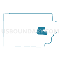
Outline

Summary
| Unique Area Identifier | 678931 |
| Name | Flowell 25 Voting District |
| County | Millard County |
| State | Utah |
| Area (square miles) | 228.22 |
| Land Area (square miles) | 220.74 |
| Water Area (square miles) | 7.48 |
| % of Land Area | 96.72 |
| % of Water Area | 3.28 |
| Latitude of the Internal Point | 39.00542460 |
| Longtitude of the Internal Point | -112.64301800 |
Maps


Graphs
Select a template below for downloading or customizing gragh for Flowell 25 Voting District, Millard County, Utah


Neighbors
Neighoring Voting District (by Name) Neighboring Voting District on the Map
- Deseret / Oasis 5 Voting District, Millard County, UT
- Fillmore 1 Voting District, Millard County, UT
- Fillmore 2 Voting District, Millard County, UT
- Holden 8 Voting District, Millard County, UT
- Kanosh 4 Voting District, Millard County, UT
- Meadow 3 Voting District, Millard County, UT